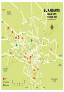
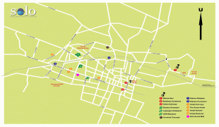
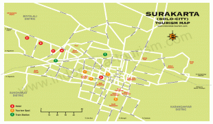
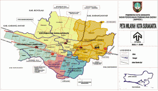
Surakarta
 |
Surakarta is the birthplace of the current President of Indonesia, Joko Widodo. He served as Mayor of Surakarta from 2005 to 2012.
Hominid habitation in the region of Surakarta is evidenced from roughly one million years ago, the age of the "Java Man" skeleton found 80 kilometers upstream. Another famous early hominid from this area is called "Solo Man".
The Surakarta area was part of the Mataram Kingdom and in this time a village called Wulayu seems to have already existed in or around the present-day city of Surakarta, as evidenced by a ferry charter issued by Balitung in A.D. 904. The Majapahit empire renewed this ferry charter in 1358.
By the 18th century, the village had acquired the name of Sala. This name is said to be derived from the sala tree. As the Javanese pronunciation "Sala" ([sɔlɔ]) was considered difficult to pronounce by the Dutch, the name later morphed into "Solo" ([solo]).
In 1745, on the basis of astrological calculations and Dutch commercial interest, Surakarta was chosen to be the new capital of the Mataram Sultanate which was on the verge of becoming a vassal state of the Dutch East India Company. The formal name is derived from the previous capital Kartasura. The official court history claims that Surakarta originally stood on a lake, which was drained by the favor of the mythical queen of the southern sea, Kanjeng Ratu Kidul.
In the ensuing colonial era, the kingdom of Mataram was divided into the Surakarta Sunanate (northern court) and the Yogyakarta Sultanate (southern court). Surakarta ruled by hereditary monarchs, who were given the unique Javanese cultural title Susuhunan. Since both Surakarta and Yogyakarta had become vassal states of the Dutch, traditional court arts, notably gamelan, were developed to demonstrate cultural power instead of developing military power.
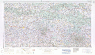
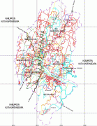
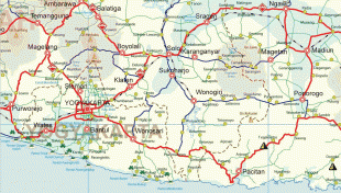
Map - Surakarta
Map


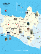


Country - Indonesia
 |
 |
| Flag of Indonesia | |
As the world's third largest democracy, Indonesia is a presidential republic with an elected legislature. It has 38 provinces, of which nine have special status. The country's capital, Jakarta, is the world's second-most populous urban area. Indonesia shares land borders with Papua New Guinea, East Timor, and the eastern part of Malaysia, as well as maritime borders with Singapore, Vietnam, Thailand, the Philippines, Australia, Palau, and India. Despite its large population and densely populated regions, Indonesia has vast areas of wilderness that support one of the world's highest level of biodiversity.
Currency / Language
| ISO | Currency | Symbol | Significant figures |
|---|---|---|---|
| IDR | Indonesian rupiah | Rp | 2 |
| ISO | Language |
|---|---|
| NL | Dutch language |
| EN | English language |
| ID | Indonesian language |
| JV | Javanese language |